Team Robovation
Land slide prediction and zone based alert system
Government Engineering College Idukki
1. S M Muhammed Azhar
2. Nitha Shahul
3. Alfiya K S
4. Gokul Prakash
🇮🇳
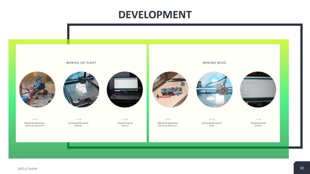
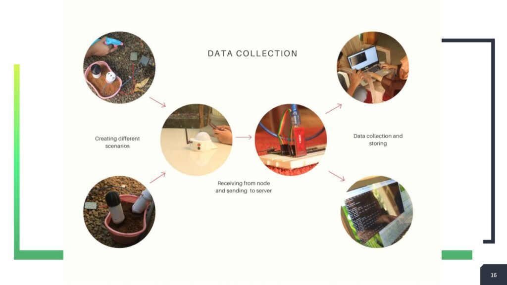
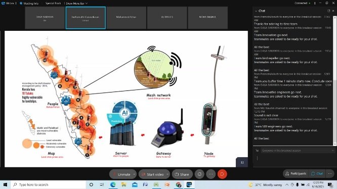
Landslide is a geological hazard caused when masses of rock earth and debris flow down a steep slope during periods of intense rainfall and accumulation of water. We use soil temperature and rainfall tracking sensors. Before the landslide happens there will be an internal movement inside the soil which will be detected using highly accurate vibration tilt sensors. We have designed a network with LoRa. By utilizing the mesh network of this system nodes and gateway which is a capsule type small device.
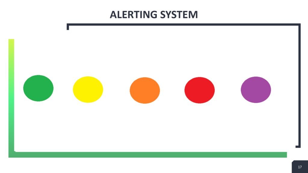
It sends information to the district disaster management agency when it crosses the threshold value. Different terrains require different threshold values which are set by taking values from the previous landslide cases and through learning the situations with the help of machine learning technique. Discrete areas will be divided into zones and the people residing in those areas will get the information via different media. Each possibility of landslide will be divided into a code-based intensity. On getting advanced information of the fore coming disaster people can shift and take the required action.
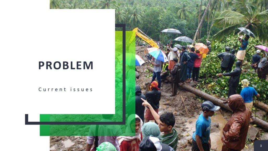
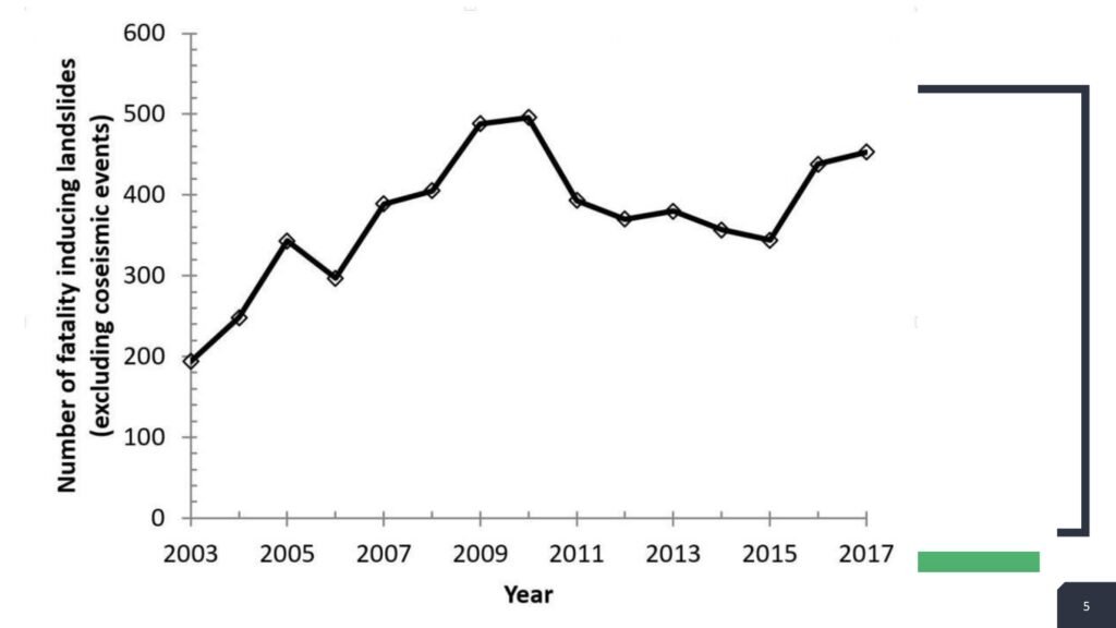
In 2018 and 2019 there were about 5000 landslide cases in Kerala which were of small, medium and high intensity. The impact of landslide can be extensive including loss of life, destruction of infrastructure, damage to land and loss of natural resources.
We have developed a system for predetermining the possibility of an upcoming landslide by converting the landslide prone areas into different zones and provide colour code-based warning.
Landslide is a geological hazard caused when masses of rock earth and debris flow down a steep slope during periods of intense rainfall and accumulation of water. We use soil temperature and rainfall tracking sensors. Before the landslide happens there will be an internal movement inside the soil which will be detected using highly accurate vibration tilt sensors. We have designed a network with LoRa. By utilizing the mesh network of this system nodes and gateway which is a capsule type small device. It sends information to the district disaster management agency when it crosses the threshold value. Different terrains require different threshold values which are set by taking values from the previous landslide cases and through learning the situations with the help of machine learning technique. Discrete areas will be divided into zones and the people residing in those areas will get the information via different media. Each possibility of landslide will be divided into a code-based intensity. On getting advanced information of the fore coming disaster people can shift and take the required action.


Use of this website signifies your agreement to the IEEE Terms and Conditions. A not-for-profit organization, IEEE is the world’s largest technical professional organization dedicated to advancing technology for the benefit of humanity.
Get more updates
IEEE YESIST12
Copyright © 2024. All rights reserved.


